Land Use Analysis
Overview
The 2013 Freight North Texas Inventory identified numerous follow-up studies aimed at constructing a more detailed picture of goods movement in North Central Texas. An analysis of freight land use throughout the region was conducted as part of this effort, and the finalized study was published in 2022. Multiple aspects of freight transportation infrastructure were examined, with a key focus being on how freight land uses (manufacturing, distribution, warehousing, railroads, etc.) interacted with surrounding communities. The final section of the report includes a policy toolkit containing best practices and recommendations to aid local governments and land use decision makers in remediating land use conflicts and preserving freight infrastructure in the urban core.
Land Use Analysis Completed Document
The study identified six major freight land use types within the North Central Texas region:
Type 1: Warehouse 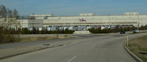
Type 2: Railroad 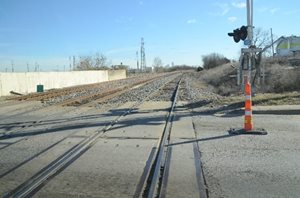
Type 3: Air Cargo Transportation 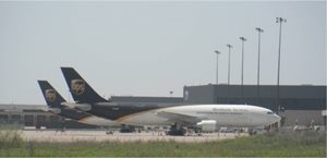
Type 4: Pipeline and Public Works 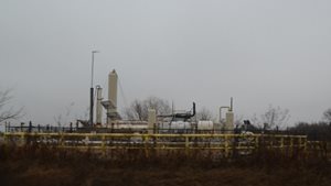
Type 5: Manufacturing and Processing 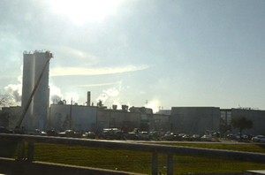
Type 6: Intermodal Facilities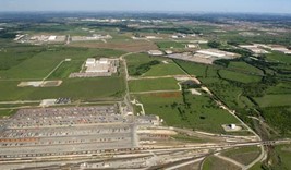
Freight Facility Dispersion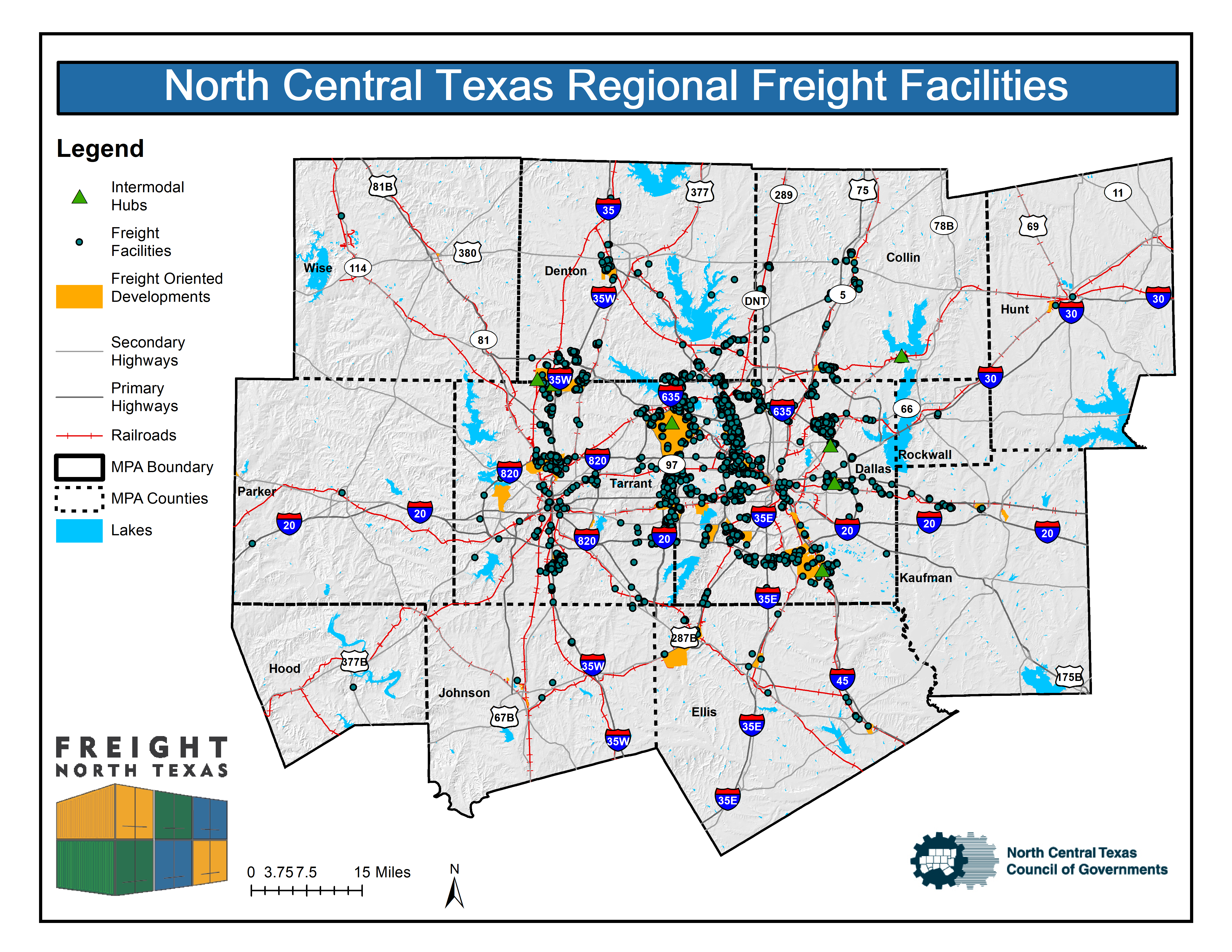
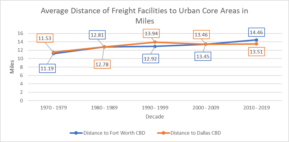
One key metric pertaining to the development of freight land use from a regional view is the extent to which they distanced from the densest population centers, which also tend to be the centers of greatest economic activity. The further logistics infrastructure is located from their largest customers, the more miles must be driven by truck in order to reach their destination, which has negative impacts for air quality, safety, and profitability. For this analysis, the distance between freight facilities and the two urban cores were measured and analyzed over time. The results indicated that the phenomenon known as freight sprawl is occurring, wherein newer freight facilities are more likely to be developed in the periphery of the urbanized area. However, this was somewhat mitigated by the freight development cluster which surrounds the DFW airport and serves clients throughout both core urbanized areas.
Land Use Conflicts
One of the most important aspects of freight land use development, aside from the vital role it plays in facilitating the multimodal transportation of goods, is the extent to which it coexists positively with surrounding land uses. It is for this reason a random sample of the 2,422 freight facilities included in the study’s dataset was analyzed. This sample included 52 sites, and each was evaluated using a standardized scoring methodology to determine whether it was a Good Neighbor site, Area of Concern, or Land Use Conflict. Areas that contained a mixture of freight and other land uses but did not fall into any of the three aforementioned categories were designated as Mixed Freight Areas and will be monitored as development of these areas continue. This aspect of the study highlighted that although it is the common practice to collocate industrial properties in close proximity to one another, some types of freight land uses are able to locate near traditionally sensitive land uses (residences, schools, etc.) and avoid land use conflicts so long as proper Good Neighbor Strategies are implemented.
The NCTCOG Freight Land Use Policy Toolkit was developed to aid local governments with planning for freight facilities to reduce conflict and improve quality of life for residents. It relies on information gathered from a literature review of freight land use planning publications, technical reports, adopted plans by peer cities across the country, and a review of policies contained within Mobility 2045 Update, the NCTCOG metropolitan transportation plan. The toolkit sets forth the framework for an iterative process to be undertaken by land-use decision makers at the sub-regional level and nested within local comprehensive, transportation, and community development plans.

| Freight Land Use Conflict Scoring Criteria | |
| Good Neighbor Strategies | Railroad Infrastructure |
| Sidewalks & Bicycle/Pedestrian Paths | Median Barriers |
| Raised Berms | Quad Gates |
| Supplemental Vegetation | Quiet Zone |
| Sound Walls | Offset from Sensitive Land Use |
| High-Quality Fencing | Rail-Related Connectivity Issues |
| Buffer Zones | Buffers Between Sensitive Land Use & Railroads |
| Site Design | Roadway Infrastructure |
| Loading Docks | Loading & Unloading Zones |
| Lighting | Truck-Related Roadway Damage |
| Vegetation & Fencing | Access Via Non-Residential Road |
| Staging Areas | Adequate Truck Parking |
| Freight-Oriented Development | |
| FOD Encroachment | |
| Pipeline Setbacks | |
| Environmental Justice Concerns | |