DFWMaps Marketplace Product Descriptions
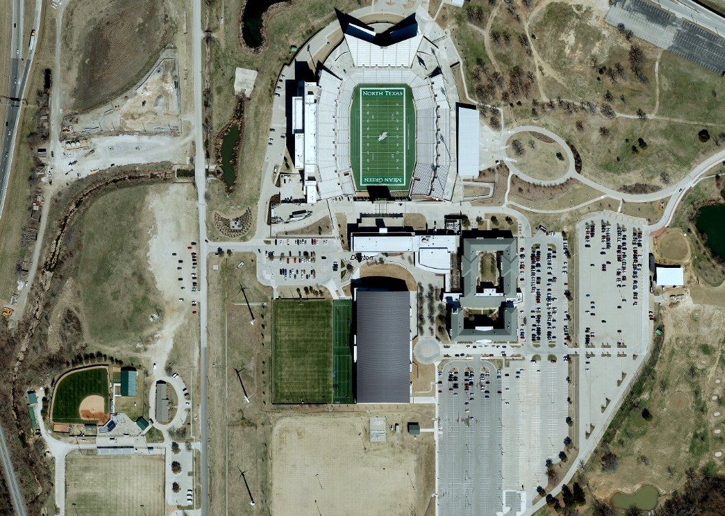 Orthophotography – Years 2001 to 2025
NCTCOG's high-accuracy, 4-band orthophotography is captured at either 1.5", 3" or 6" resolution. The final aerial photography meets The American Society of Photogrammetry and Remote Sensing (ASPRS) Class I standards and is suitable for engineering grade analysis. NCTCOG flies orthophotography during the leaf-off season (Dec-March). The imagery undergoes extensive processing and QC by the contracted vendor before delivering 4-6 months after acquisition.
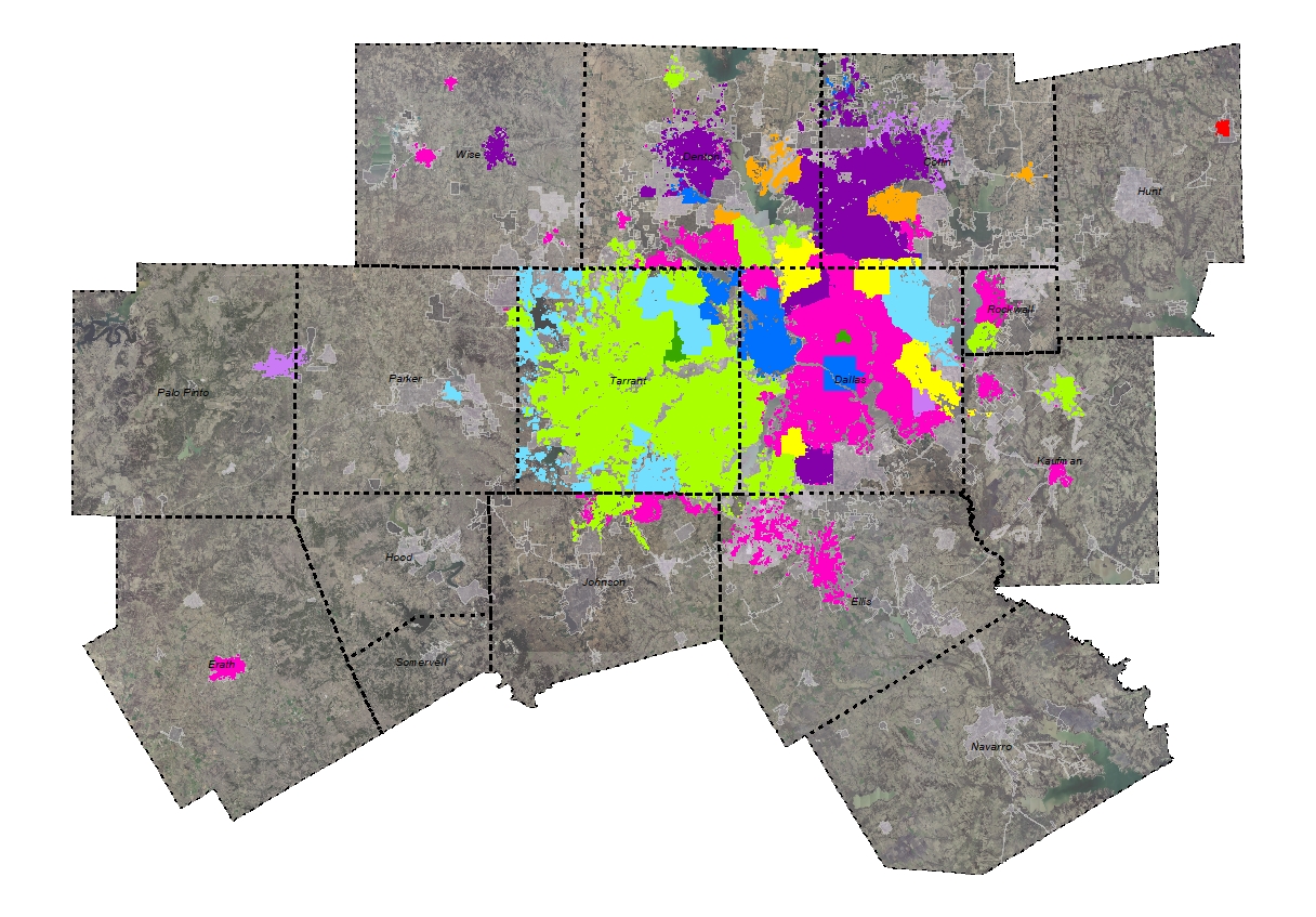 Building Footprints - Multi-year
NCTCOG's multi-year building footprint layer was developed in-house using data digitized from 6-inch aerials flown between 2007 and 2021. The data represents the most recent for any given area and includes structures of 500 sq. feet or greater. Attribution includes land use code, zip code, footprint year and elevation data for those features that have corresponding LiDAR or autocorrelated surface data (ACS). The data cover Tarrant County; much of Dallas, Denton, Collin and Rockwall counties; and parts of Ellis, Erath, Hunt, Johnson, Kaufman, Palo Pinto, Parker and Wise counties. Cities with elevation data can be found here.
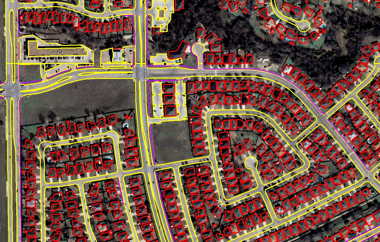 Bundled Planimetrics - 2007
In 2007, NCTCOG contracted with a vendor to digitize building footprints, paved road edges, parking lots, bridges and sidewalk centerlines for a large portion of the North Texas region. Data layers were digitized "heads-up" using the 2007 6” orthophotography and are available in GIS and CAD formats. Data do not include any attribution.
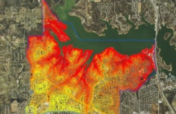
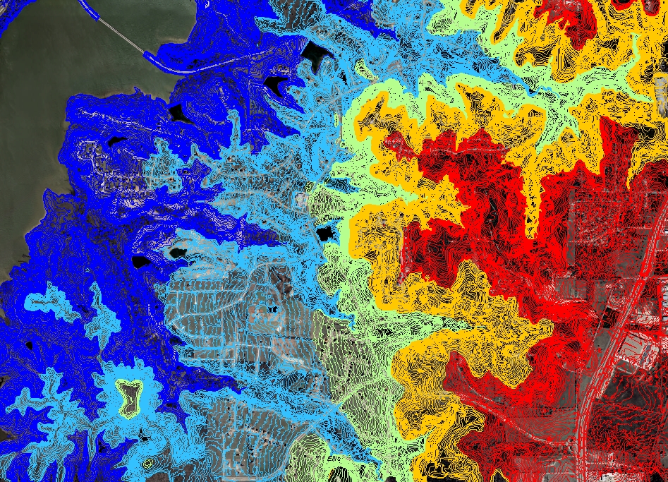
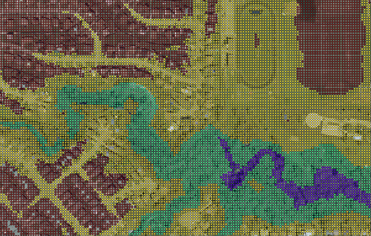
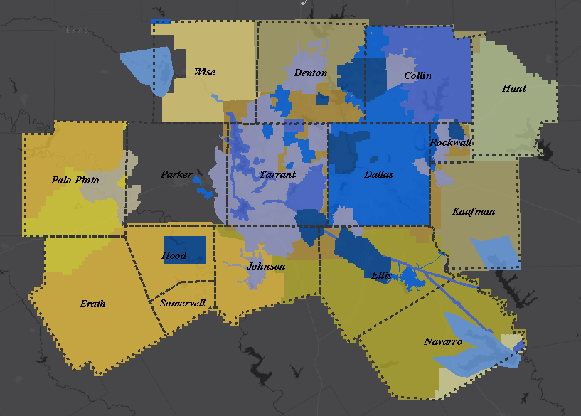 Contours (LIDAR) - Multi-year
NCTCOG’s multi-year 2’ digital elevation contour layer was developed in-house by bringing together 0.5 Meter LiDAR flown by a contracted vendor (shown in shades of blue), 0.5 Meter TNRIS LiDAR and 0.7 Meter FEMA & USGS LiDAR (shown in shades of yellow). The LIDAR data was flown from 2009 to 2019, covers all of the NCTCOG region except Parker County and represents the most recent data available for any given area (through 2019). All data was created from a hydro-flattened DEM and underwent extensive QA/QC for accuracy.
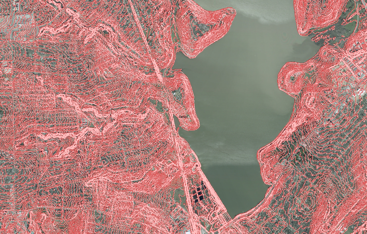
 Contours (LiDAR) - Years 2015 to 2018
For isolated areas, NCTCOG has engineering-grade 2-foot contours created by a contracted vendor. Data was derived from 0.5 Meter LiDAR data and includes hydrology and transportation break-lines. Data meets or exceeds the National Mapping Accuracy Standards (NMAS) vertical accuracies for 2-foot (1.0’ RMSE).
 Contours 2007 (ACS)
In 2007, NCTCOG and TxDOT contracted with a vendor to develop a terrain surface along with contours for the NCTCOG region plus Jack County. The technology used to develop the terrain surface is called Auto-Correlated Surface (ACS). ACS is a “single return” technology, as opposed to LIDAR which can have multiple returns for one location and the resulting data may not be as accurate as LiDAR, especially in heavily vegetated areas. ACS-derived contours are available at 2” resolution and are suitable for broad-scale cartographic purposes.
 Contours 2001 (LiDAR)
In 2001, NCTCOG contracted with a vendor to create 2’ contours for Dallas, Denton, Collin, Tarrant and Rockwall Counties. The dataset was created from 2001 LiDAR and is hydro-flattened. The contours do not include transportation breaklines, so accuracy around bridges and other transportation features is not guaranteed.
 LiDAR .5 Meter (LAS) - Years 2015 to 2024
Since 2015, NCTCOG has contracted with a vendor to collect LiDAR at a density sufficient to support a nominal pulse spacing of 0.5 meters (no less than 4 or more points per square meter). All LiDAR data includes hydrologic break-lines and follows the ASPRS Standard LiDAR Point Classes, including buildings at 98% accuracy, bare earth, vegetation and more.
 LiDAR Bare Earth (XYZ Text File) – 2001
In 2001 NCTCOG contracted with a vendor to collect LiDAR for Dallas, Tarrant, Denton, Collin and Rockwall counties. The bare earth version of the data is available in ASCII text files with elevation details included. Data includes elevation information.